
Madhya Pradesh is situated in the central region of India and that’s why it is called the Heartland State. It has the largest reserves of diamond and copper in India as Madhya Pradesh is rich in mineral resources. It came into existence in 1956. It experiences sub-tropical climate. Hot dry summer is from April to June and Monsoon Rains are from July to September. There are all total 52 districts present in Madhya Pradesh. It has 92% of Hindus and around and the remaining 8% are Muslim, Jain, Christian, Sikhs and Buddhists.


Madhya Pradesh is situated in the central region of India and that’s why it is called the Heartland State. It has the largest reserves of diamond and copper in India as Madhya Pradesh is rich in mineral resources. It came into existence in 1956. It experiences sub-tropical climate. Hot dry summer is from April to June and Monsoon Rains are from July to September. There are all total 52 districts present in Madhya Pradesh. It has 92% of Hindus and around and the remaining 8% are Muslim, Jain, Christian, Sikhs and Buddhists.
Geography of Madhya Pradesh
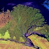
Madhya Pradesh literally means "Central Province", and is located in the geographic heart of India, between latitude 21.2°N-26.87°N and longitude 74°59'-82°06' E. The state straddles the Narmada River, which runs east and west between the Vindhya and Satpura ranges; these ranges and the Narmada are the traditional boundary between the north and south of India. The highest point in Madhya Pradesh is Dhupgarh, with an elevation of 1,350 m (4,429 ft).
It is bordered on the west by Gujarat, on the northwest by Rajasthan, on the northeast by Uttar Pradesh, on the east by Chhattisgarh, and on the south by Maharashtra.
The State has a subtropical climate. Like most of north India, it has a hot dry summer (April–June), followed by monsoon rains (July–September) and a cool and relatively dry winter. The average rainfall is about 1,371 mm (54.0 in). The southeastern districts have the heaviest rainfall, some places receiving as much as 2,150 mm (84.6 in), while the western and northwestern districts receive 1,000 mm (39.4 in) or less.
It is the second largest state in India after Rajasthan with an area of 3, 08, 000 sq. km. It is a part of peninsular plateau of India lying in north central part, whose boundary can be classified in the north by the plains of Ganga-Yamuna, in the west by the Aravali, east by the Chhattisgarh plain and in the south by the Tapti valley and the plateau of Maharashtra.
State at a Glance: Madhya Pradesh
Area
|
236,286 sq.km
|
Population
|
72,597,565 (2011 census)
|
Principal official Language
|
Hindi
|
Climate
|
Summer - March to June (Max. Temp. 45 deg. C)
Winter - Nov. to Feb. (Min. Temp 5 deg. C) |
Capital
|
Bhopal
|
Members of Lok Sabha
|
29
|
Legislature
|
Unicameral
|
Airports
|
Bhopal, Indore, Gwalior, Khajuraho, Jabalpur
|
Major Cities
|
Indore (largest city),Bhopal,Jabalpur,Gwalior,Ujjain,Sagar.
|
Festivals
|
Khajuraho Festival of Dance, Tansen Music Festival, Gwalior,Shivratri Mela, Pachmarhi,Navratri Festival(Ujjain), Malwa Utsava Ujjain and Indore
|
Economy Size
|
US$ 85 billion),
70% of total working population depends on agriculture sector.
|
Literacy
|
69.72%
|
Districts
|
51
|
Sex Ratio (as per 2011 census)
|
931 per thousand
|
Principal Folk Dances
|
Matki, Gangaur,Badhai,Baredi, Naurata, Bhagoria
|
Principal Rivers
|
Narmada, Betwa, Tapti, Chambal, Sone, Mahanadi, Shipra, Sindh and Indravati
|
Principal Minerals
|
The state has the largest reserves of diamond and copper in India. Other major mineral reserves include those of coal, coal-bed methane, manganese and dolomite.
|
Tourist & Historical Places
|
Khajuraho, Mandu, Chachai Falls, Bhimbetka,Sanchi, Gwalior, Panchmadhi, Chanderi,Orchha,Caves Of Bagh,Omkareshwar,Maheshwar,Ujjain,Amarkantak
|
According to the 2011 figures, the recorded forest area of the state is 94,689 km2 (36,560 sq mi) constituting 30.72% of the geographical area of the state. It constitutes 12.30% of the forest area of India. Legally this area has been classified into "Reserved Forest" (65.3%), "Protected Forest" (32.84%) and "Unclassified Forest" (0.18%). Per capita forest area is 2,400 sq. m (0.59 acres) as against the national average of 700 sq. m (0.17 acres). The forest cover is less dense in the northern and western parts of the state, which contain the major urban centres. Variability in climatic and edaphic conditions brings about significant difference in the forest types of the state.


0 Comments